October 8, 2025
3 min read
Science behind Record-Breaking Everest Blizzard That Trapped Hundreds
A blizzard that trapped hundreds of trekkers on Mount Everest was truly “off the charts,” experts explain
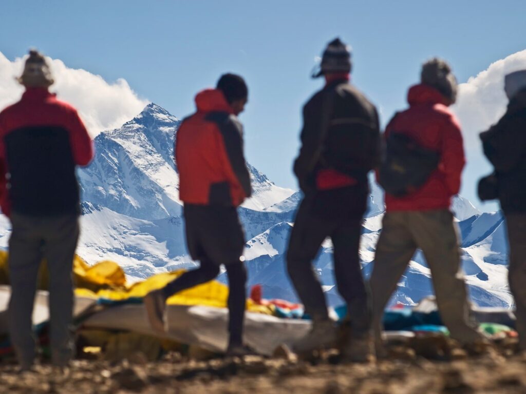
Hundreds of trekkers were recently trapped on Mount Everest, which is shown here in a stock photo.
DavorLovincic/Getty Images
A blizzard that trapped hundreds of trekkers on the north side of Mount Everest last weekend captured headlines for its proximity to the famed peak. But less appreciated was the truly bizarre nature of the blizzard: the amount of snow that fell within 12 hours was 3.5 times greater than anything measured at the mountain before.
“It’s off the charts in terms of the six-year record we have from the weather stations on Everest,” says Tom Matthews, a climate scientist at King’s College London, who co-led the expedition to the highest weather station on earth at Everest in 2019. He uses a comparison to human heights to drive home the oddity: “Over the last six years,” he says, “the tallest person you might have seen was someone six feet, seven inches come to base camp; on [October] 4 a giant 23 feet tall rolled up.”
About 900 trekkers and guides were rescued in the days after the storm, according to the Associated Press. These individuals were trekking to and around the base camp on the mountain’s north side in Tibet during China’s National Day and Mid-Autumn Festival holiday break. In Nepal the precipitation fell as rain, causing widespread flooding and landslides that killed at least 47, according to Al Jazeera.
On supporting science journalism
If you’re enjoying this article, consider supporting our award-winning journalism by subscribing. By purchasing a subscription you are helping to ensure the future of impactful stories about the discoveries and ideas shaping our world today.
The heavy blizzard dropped around three feet of snow in the Gama Valley of Tibet last Friday and Saturday, according to reporting. This came during a period that is typically dry and mild in the region. The rainy monsoon season in Tibet and Nepal runs from May to mid-September. Most climbers try to summit Everest in the spring, before the monsoon begins. The few climbers who do attempt the peak in October are lured by smaller crowds and typically clear skies.
But it wasn’t climbers who were most affected by the storm. The people who were trapped by the snow that fell on October 3 and 4 were tourists trying to peer up at the mountain from its base in Tibet’s Tingri County. A popular four- to five-day trek takes adventurous tourists from the village of Old Tingri to Everest’s northern base camp, called North Base Camp, which sits around 17,000 feet above sea level. People can also now drive to North Base Camp, says Kent Moore, a professor of atmospheric physics at the University of Toronto Mississauga, who studies mountain meteorology. Last weekend the route may have been more crowded than usual because of the holiday.
“It’s easy to put yourself in a situation that’s quite dangerous now,” Moore says. Twenty years ago the event would have been a “nothingburger,” he adds, because nobody would have been in the area. But infrastructure improvements in Tibet have drawn more and more people to Everest’s remote north side. And because it’s easy to get to North Base Camp quickly, such tourists may not be as acclimated to high elevation as trekkers to the mountain’s South Base Camp in Nepal, which requires about a two-week hike to reach from Kathmandu.
“A snowstorm at sea level is not a big deal,” Moore says. “But when you’re at 5,000 meters [16,440 feet], everything is just harder to do.”
According to Nepal’s Department of Hydrology and Meteorology (DHM), a low-pressure system in the Bay of Bengal intensified the monsoon that triggered the precipitation. Trekkers also reported wind and near-continuous lightning on Everest’s north side. Meteorologists are still analyzing the weather pattern, Matthews says. But two low-pressure systems, one on either side of India, may have contributed to the event by funneling high levels of water vapor from the Bay of Bengal into the Everest region. Possibly exacerbating the issue, Moore says, was the fact that the surface of the Bay of Bengal is currently two degrees Celsius warmer than its historical monthly average. Warmer water evaporates more readily, providing more vapor that could then condense into snow.
Heavier precipitation events are expected to increase as the climate warms, Moore says. “That’s just because, when the air is warmer, it can hold more water vapor,” he adds. “Water vapor is what leads to storms and what leads to precipitation.”
As of October 6, the monsoon was withdrawing from the region, according to Nepal’s DHM.
It’s Time to Stand Up for Science
If you enjoyed this article, I’d like to ask for your support. Scientific American has served as an advocate for science and industry for 180 years, and right now may be the most critical moment in that two-century history.
I’ve been a Scientific American subscriber since I was 12 years old, and it helped shape the way I look at the world. SciAm always educates and delights me, and inspires a sense of awe for our vast, beautiful universe. I hope it does that for you, too.
If you subscribe to Scientific American, you help ensure that our coverage is centered on meaningful research and discovery; that we have the resources to report on the decisions that threaten labs across the U.S.; and that we support both budding and working scientists at a time when the value of science itself too often goes unrecognized.
In return, you get essential news, captivating podcasts, brilliant infographics, can’t-miss newsletters, must-watch videos, challenging games, and the science world’s best writing and reporting. You can even gift someone a subscription.
There has never been a more important time for us to stand up and show why science matters. I hope you’ll support us in that mission.

