On arriving at work one day last October, ecologist Koen de Koning did what he often does first thing in the morning: he fired up the Crane Radar. The interactive web application showed a flock of cranes heading his way. Excitedly, he dashed outside, looked up and, sure enough, 60 or so birds flew past on their migration route south.
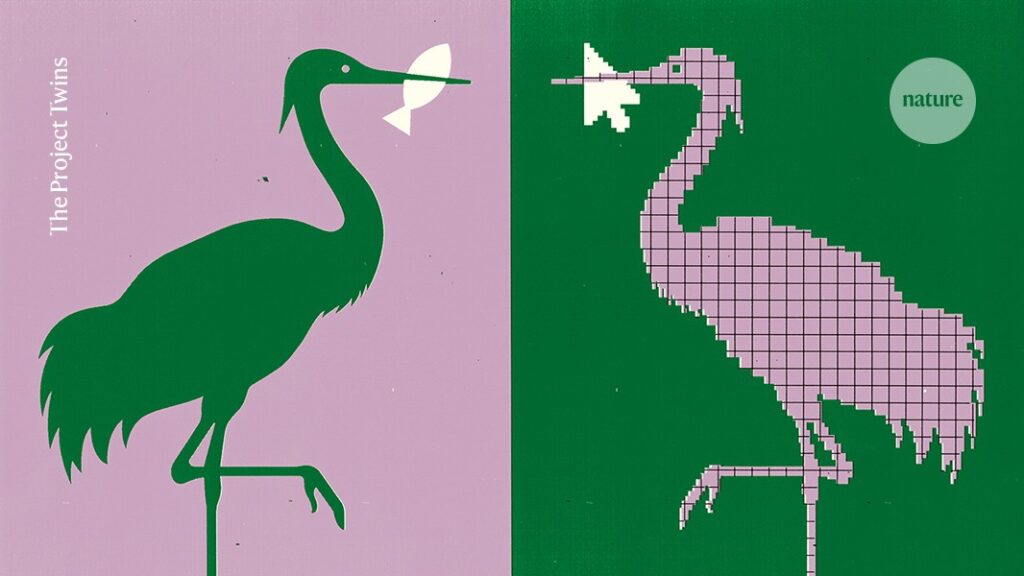
The Crane Radar is a digital twin — a virtual representation of a real-world entity and a relatively new technology in ecology (see go.nature.com/46rbkg4). “I’ve definitely seen more of the migration because of the radar. And I’m learning more about the migration patterns as well,” says De Koning, who works at Wageningen University & Research in the Netherlands and is a keen birder.
In fields such as manufacturing, infrastructure and health care, the technology has been used to model objects from electronics components to UK hospital wards and even the nation of Singapore.
How a vast digital twin of the Yangtze River could prevent flooding in China
Their purposes vary. Digital twins can make life easier for individual users — Google Maps, for example, is continuously updated to help drivers to navigate traffic. Other programs can predict the effects of climate change on cities, plan architecture or simulate surgical procedures. HeartNavigator, a software package from the Dutch health-technology firm Philips, can be used to plan heart operations such as valve replacements, simulating surgery using various models and sizes of valve to find the best fit for a patient.
NASA used what is often considered the first digital twin (then called a living model) in 1970 to work out why an oxygen tank exploded on the Apollo 13 lunar mission and to bring the astronauts home safely. The agency’s principal technologist, John Vickers, coined the term digital twin in 2010, a few years after US systems engineer Michael Grieves formalized the concept in a presentation to the manufacturing industry when he was co-director of the Project Lifecycle Management Development Consortium at the University of Michigan in Ann Arbor.
Over the past decade, there has been a marked increase in the development of digital twins across a range of fields. This is mostly because of the increasing availability of data, the prevalence of devices connected to the Internet of Things (IoT) and the development of artificial intelligence (AI) and cloud computing. The global digital-twin market is forecast to grow by more than sevenfold over the next 5 years, according to one report — from US$21 billion this year to $150 billion in 2030 (see go.nature.com/4nctfu2). The fastest growth is anticipated in health care, the report says, owing to the technology’s potential for reducing errors and improving diagnoses and surgical outcomes.
For ecologists, digital twins present unique opportunities. But there are limitations that need to be addressed, from ensuring adequate data access to sustainable funding.
Ecological digital twins
Digital twins can be particularly useful for studying systems that are changing outside historical norms, says Anna Davison, who is researching digital twins in ecology at Wageningen University & Research. That includes how ecosystems react to anthropogenic climate change. So it’s perhaps no surprise that ecologists are increasingly using digital twins to tackle gaps in biodiversity research brought about by ecosystem complexities, ponderous government action and a lack of real-time monitoring.
Launched in 2022, the Crane Radar is one of four digital twins developed by Wageningen University & Research as part of a €300,000 (US$352,000) project funded by the European Union, called Nature FIRST. It forecasts the migration of common cranes (Grus grus) across the Netherlands, Belgium, Luxembourg, northern France and northwestern Germany, helping birdwatchers and ecologists to locate the flocks as they traverse the region.
De Koning says he chose crane migration as the focus of his first digital twin because of the abundance of data and because it is a relatively simple process to model. He also had a personal motivation: “I was always in the wrong location or at the wrong place at the time” to see the cranes, De Koning jokes. “This model really helped me, personally, to see them more often.”

Sims-style ‘digital twin’ models can tell us if food systems will weather crises
To build a digital twin, scientists first need to collect the relevant data for the real-world entity, whether that be real-time data from IoT devices or historical records. Then they must develop algorithms to mimic the behaviour of the physical twin and test the model — for example, by fitting historical data sets to recent ones — before applying the trained model to real-time data.
Created over the course of about a year and costing roughly €15,000–20,000, the Crane Radar uses migration data (sourced from Movebank, an online animal-tracking database), real-time sightings by birdwatchers and factors such as wind speed and direction of flight to estimate where the birds will be within the next four hours (K. De Koning Ecol. Inform. 85, 102938; 2025).
Wageningen researchers partnered with Sensing Clues, a conservation technology non-profit organization in Amsterdam, to transform their models into platforms that can be easily accessed and understood by end users — members of the public, policymakers and other researchers.
Birdwatchers can also log sightings (including the location, time, direction of flight and number of cranes) through Observation.org, a citizen-science platform for biodiversity. The crane digital twin updates every minute; the website has a slight lag, updating every five minutes with a four-hour forecast for each sighting.
The Crane Radar has been well received by Dutch birders. It receives an average of 100,000 daily visits during peak migration season in late October and early November, dipping down to 1,000 on quieter days. After it was featured by Dutch national news, however, more than 300,000 users engaged with the app each day over the subsequent weekend, De Koning says.
“It’s a really nice, completely closed loop where the end user is also the data provider,” says Davison, who has developed a digital twin for the migration of Beluga sturgeon (Huso huso) in the Danube River delta.
Modelling ecosystems
A more complex digital twin is being built to mirror ecosystems in Doñana National Park in southern Spain.
“The park is a key essential biodiversity area in Europe – however, it is threatened by multiple human activities,” says Maria Paniw, a researcher at Doñana Biological Station in Seville. Threats include overexploitation of water, agricultural development outside the park, tourism and climate change. “We wanted to understand how all these different factors affect the ecosystem in a real-time complex setting, not through simple approximations based on single species that we typically do in ecology.”
The first effort by Paniw’s team models interactions between vegetation, rabbits and the Iberian lynx (Lynx pardinus), a ‘keystone species’ in the park. Its conservation status has recently improved — it moved from endangered to vulnerable status last year, thanks to efforts to boost its numbers, including protection of habitat and translocations of the animals to expand its genetic diversity.

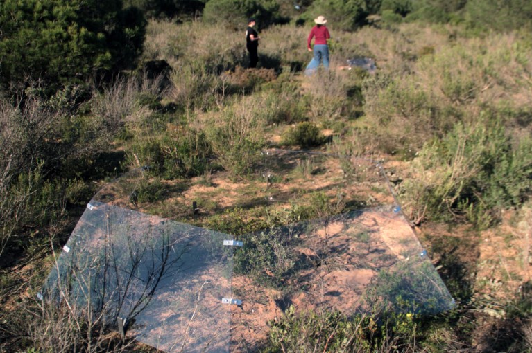
Researchers set up digital-twin experiments in Spain’s Doñana National Park.Credit: Hanna Serediuk/Doñana Biological Station (EBD-CSIC)
Alongside a detailed database of lynx reproduction statistics and movements (all reintroduced lynx have GPS tracking collars) and rabbit data from hunting organizations and other national parks, the researchers use a metric called the normalized difference vegetation index. This measures the verdancy of landscapes and is constantly updated using satellite imagery to assess changes in plant density and health. The aim is to show how rabbits respond to changes in vegetation and weather, and how lynx, in turn, respond to changes in rabbit abundance. The findings will inform where lynx can be best reintroduced into the environment and where they might move from those release sites.
“We basically started with part of the system that has the most data and the most urgent need to get something done,” explains Paniw. She hopes that this approach will convince park managers of the usefulness of digital twins before they build more complex models. “They need to see value in this.”
Other researchers have built digital twins of river systems across Europe, Africa and Asia. A digital twin of the River Stiffkey in southeastern England was built by regional water company Anglian Water and partners including Microsoft and the University of Suffolk, UK. The aim is to model strategies to improve the health and biodiversity of the chalk-stream habitat — a rare type that is threatened by warming water and pollution. Digital twins of the Yangtze River in China and parts of the River Douro in Portugal are also in development, along with three twins of rivers in Kenya.
Rivers are “a rich environment for demonstrating the viability of these models,” explains computer scientist Lawrence Nderu, chair of the Department of Computing at Kenya’s Jomo Kenyatta University of Agriculture and Technology near Nairobi. “They are very dynamic.”
Nderu is developing a twin of the Mara River basin in Narok County, southwestern Kenya, as part of a collaboration between his university and the Slovenian space technology organization Space-SI in Ljubljana, which builds applications to acquire satellite data.
The Narok area is hit with periodic severe flooding that can be life-threatening. Nderu’s team is designing its digital twin to alert communities and authorities to predicted flooding events, integrating data from weather stations, soil sensors and satellites, together with information about the river system and surrounding landscape. That should allow vulnerable populations to plan ahead, he says. Nomadic herders, for example, can move their cattle to higher ground.
“Otherwise, we will always be talking about what should have been done, which is always a very costly conversation,” Nderu adds.
Twin challenges
That reliance on up-to-the-minute data, however, reveals a key challenge for digital twins: having sensors in the field is one thing, but they need to be connected to the Internet for the data to be useful. Data quality can be an issue, too – De Koning says citizen observations of cranes, for example, often include inaccurate time stamps, locations or identification, which can muddle the resulting models.
For Nderu, there is also the issue of data storage. His digital twins require volumes of data — including about 2.5 terabytes of compressed video files per year — that can be costly to store in the cloud in Kenya (he estimates about US$800 annually). “We are trying to approach [cloud] companies like AWS to provide us with that,” he says.
De Koning says that because digital twins are so new, people are often unaware of their potential. Scientists need to first explain possible outcomes before users can express how a digital twin could be helpful to them.

The Internet of Things comes to the lab
Also a challenge, Paniw and Davison say, is sustainability — specifically, balancing the short-term nature of research funding with the length of time it takes to build a digital twin and the cost of maintaining it.

