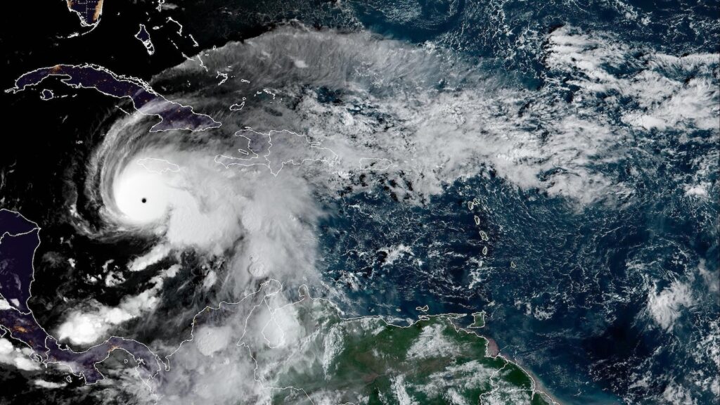
Hurricane Melissa, now a powerful Category 5 storm with winds of 175 mph, will slam into Jamaica as the worst storm the island has ever seen.
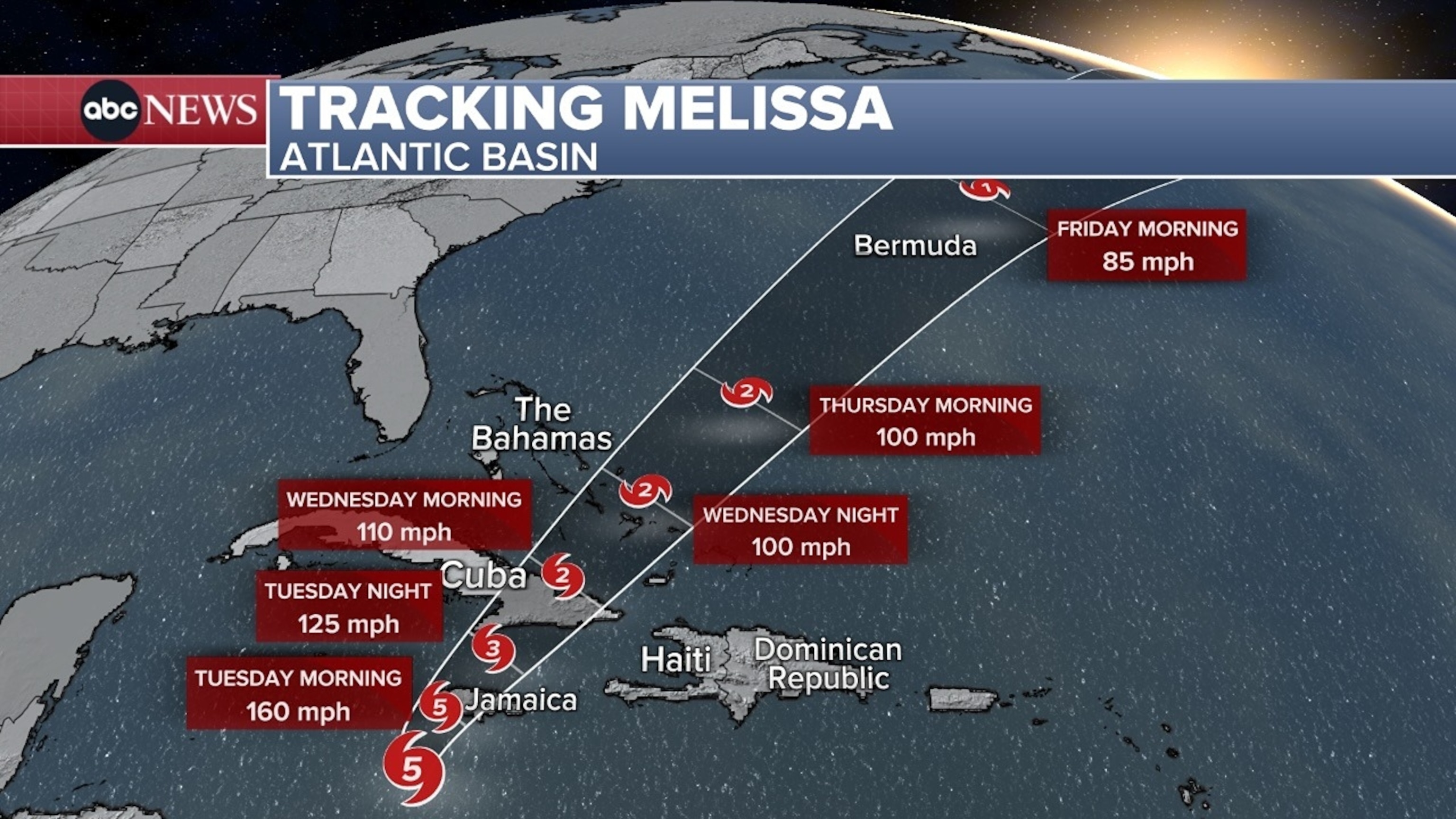
Here is Melissa’s forecast path:
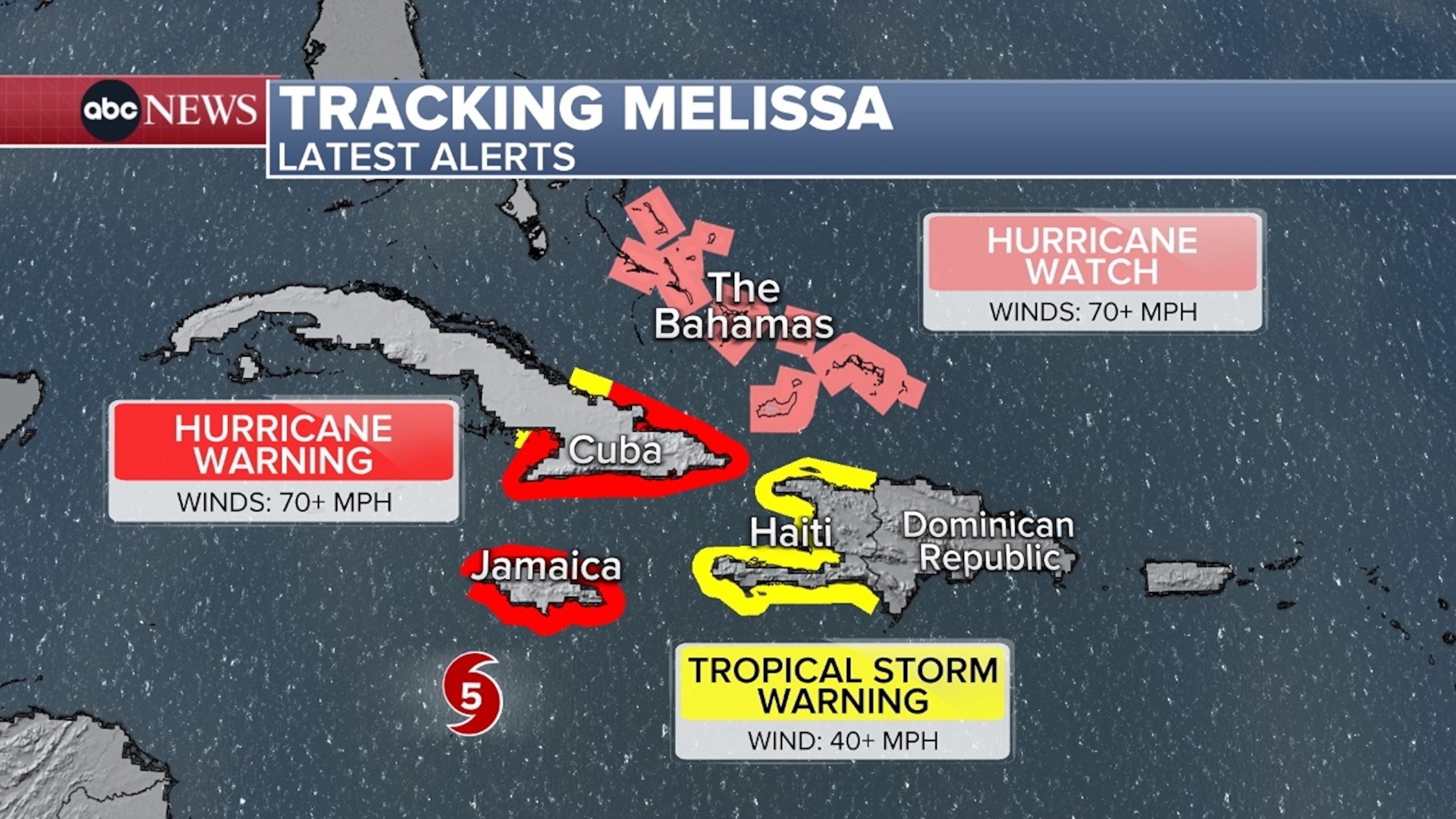
The catastrophic and life-threatening hurricane-force winds will begin in Jamaica on Monday night.
Melissa is expected to make landfall in Jamaica on Tuesday morning.
Tracking Hurricane Melissa in the Atlantic Basin.
ABC News
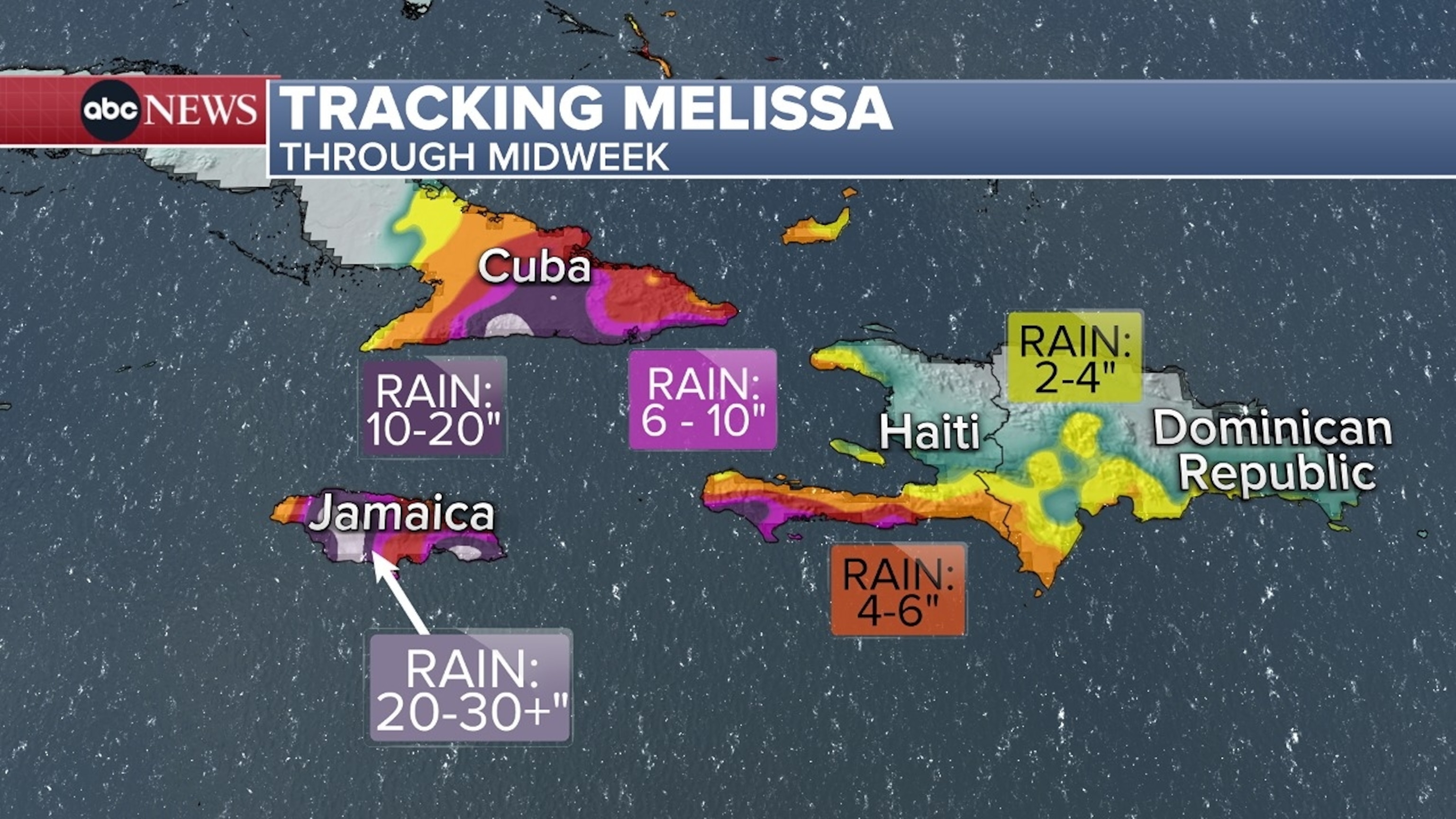
Melissa is moving very slowly, so it will bring a deluge of rain to Jamaica, with totals forecast to reach 15 to 30 inches and even up to 40 inches in localized areas. This will spark catastrophic and life-threatening flash flooding on Monday and Tuesday.

Tracking Hurricane through midweek.
ABC News
Storm surge will decimate parts of the southern coast with water surging up to 13 feet above ground level.
Jamaicans should be prepared for extensive infrastructure damage and long-lasting power outages.
Melissa’s outer bands will also bring some tropical storm conditions to Haiti on Tuesday.

Tracking Hurricane Melissa latest alerts.
ABC News
Then, by Tuesday night, Melissa will move away from Jamaica and toward eastern Cuba. Eastern Cuba could see 15 to 20 inches of rain, triggering dangerous flash flooding and landslides.
On Wednesday afternoon, Melissa will approach the southeast Bahamas, where 4 to 8 inches of rainfall is forecast.
Melissa might then bring hurricane impacts to Bermuda by Thursday.

Tracking Hurricane Melissa in the Atlantic Basin.
ABC News

